Hidden Beaches French Riviera: Best Guide to Secluded Coves
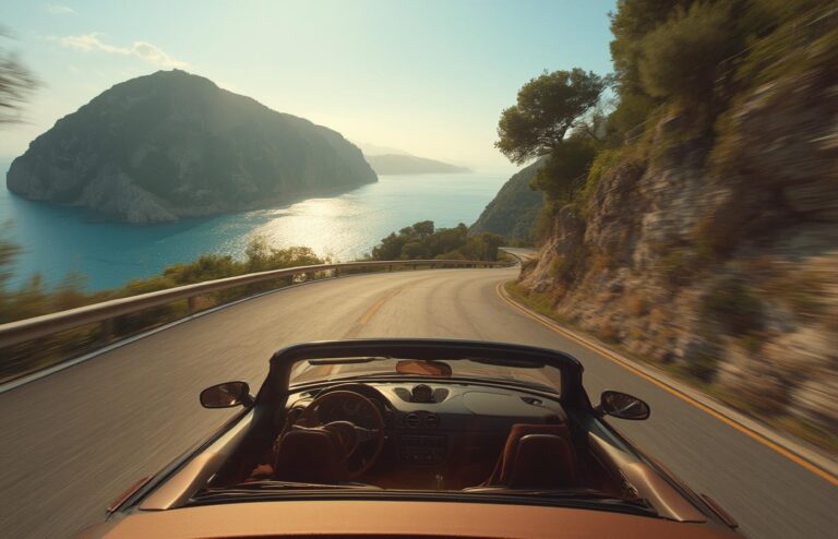
Hidden beaches French Riviera don’t truly mean unknown this decade—but if you’re willing to put in extra effort, you’ll still find quiet coves untouched by crowd-chasing travel blogs. This guide offers evidence-based, outdoor-ready plans to reach secluded stretches, including costs, safety, exact access routes, and conservation essentials for 2024.
Key Takeaways
- “Hidden” beaches require real effort: 20–60 minutes hiking, paid parking, or boat/kayak access—there is never direct, free parking.
- You must bring all food, water, shade, and first aid to secluded beaches; there are no lifeguards or services on-site.
- Official rules for protected areas in 2024 mean stricter parking enforcement, seasonal path closures, and conservation etiquette.
- What “hidden” really means on the French Riviera
- Quick shortlist — 7 low-profile coves worth seeking
- Step-by-step: How to reach 5 top secluded beaches
- Practical access, parking, and public transport — exact steps
- 2024 regulations, conservation rules, closures
- Typical day-trip costs and packing checklist
- Common traveler problems & local fixes
- Safety checklist — must-pack and on-site precautions
- Three secret beaches rarely in major guides
- Sample day-trip itineraries
- Advanced analysis & pitfalls: What no blog warns you
- Conclusion
- FAQ
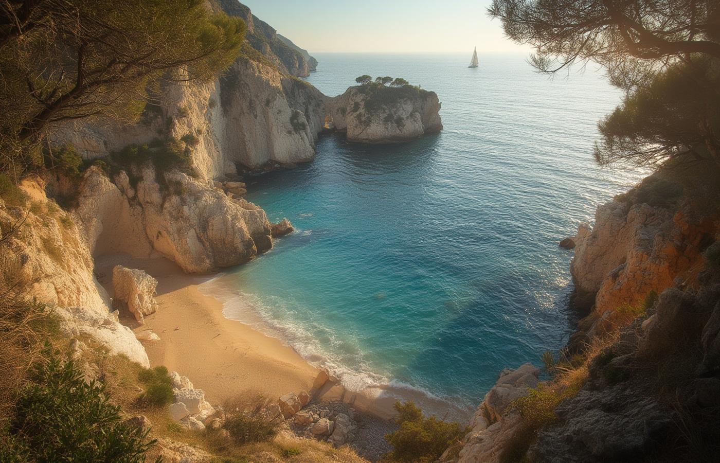
What “hidden” really means on the French Riviera
In 2024, hidden beaches French Riviera and undiscovered beaches French Riviera aren’t a myth—but they demand realistic expectations. “Truly undiscovered” now indicates:
- Remote access only: Strictly no direct parking and never at the water’s edge.
- No or minimal services: No food, toilets, rental, or lifeguards.
- Significant effort: Steep, rocky coastal paths, or kayak/boat arrival only.
- Regulated by environment: Park or reserve rules limit numbers and impact.
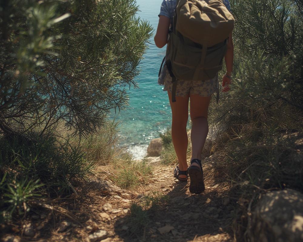
Access takes effort. Expect 20–60 minute hikes or planning transport steps in advance. These spots remain quiet because they’re inconvenient, not because they’re secrets on the internet.
Quick shortlist — 7 low-profile coves worth seeking
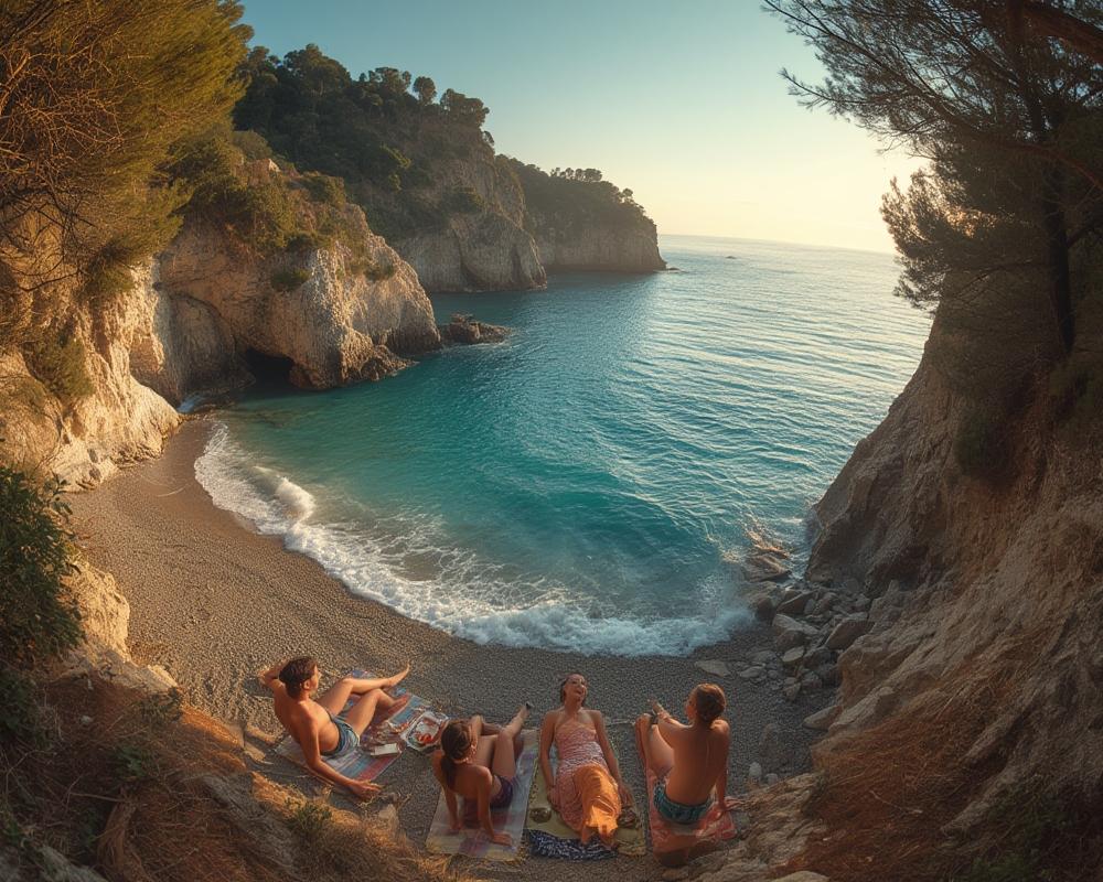
Based on local reports and site visits, these hidden gems retain relative solitude and low footfall compared to mainstream beaches:
- Plage du Grand Jardin (Bormes-les-Mimosas): 20 min hike west from Plage de l’Estagnol, only paid private parking.
- Plage de la Bastide Blanche / Cap Taillat (Ramatuelle): 1 hour hike or kayak from Plage de l’Escalet, in a nature reserve, no car access.
- Calanque des Anglais (Corniche d’Or): Three tiny cliff-below coves, reached by steep stairs off roadside lay-bys.
- Pointe de l’Aiguille (Théoule-sur-Mer): Park then descend into a stunned red-rock amphitheatre, rocky water entry, NO crowds on low season weekdays.
- Anse de l’Éléphant (near Le Lavandou): Emerald green, tiny, walk-only cove next to Plage Jean Blanc.
- Île Sainte-Marguerite coves (Cannes offshore): Accessible only by ferry, remote forest footpaths, wild pebbly coves.
- Plage de Fazzio (Cap d’Antibes): Discreet pebble inlet in pine woods, reached via coastal footpaths.
These were chosen using “evidence-based, relatively quiet or under-the-radar” local recommendations—not recycled top 10 lists.
Step-by-step: How to reach 5 top secluded beaches
1. Plage du Grand Jardin (Bormes-les-Mimosas)
- Start: Park only at Plage de l’Estagnol’s private car lot (8 € for 2024—no street or free parking anywhere nearby).
- Route: From the lot, go left (west) along the marked coastal path for 20 minutes. It’s moderately rocky and exposed (wear closed shoes).
- What to expect: Absolutely no toilets, shops, or rescue services. Ideal for hikers or couples, not for families with gear.
- Coords for planning: ~43.090°N, 6.327°E.
2. Plage de la Bastide Blanche / Cap Taillat (Ramatuelle)
- Start: Park at Plage de l’Escalet’s official car park.
- Route: Choose the sentier du littoral for a 1 hour hike, or rent a kayak in advance to paddle there.
- Critical: This is a nature reserve—vehicles, wild camping, fires, and even drones are strictly forbidden after the car park. Take out everything you bring in.
- Coords: ~43.181°N, 6.620°E.
3. Calanque des Anglais (Corniche d’Or)
- Start: Find a roadside lay-by on the Corniche d’Or between Saint-Raphaël and Cannes (small, fills by 9am in summer).
- Route: There are steep staircases and uneven rocks to descend to the coves—avoid in storms or wet weather.
- Note: No facilities, no lifeguards, easy to slip—best for agile adults.
- Coords: ~43.474°N, 6.898°E.
4. Pointe de l’Aiguille (Théoule-sur-Mer); Anse de l’Éléphant; Île Sainte-Marguerite; Fazzio
- Pointe de l’Aiguille: Park in Théoule village or Corniche lay-by, then descend 10 mins into the Parc. Snorkel from rocky shore (~43.500°N, 6.933°E).
- Éléphant: Park at Plage Jean Blanc. Walk coast path east 10–15 mins. No sign—cove sits directly under pines (~43.121°N, 6.381°E).
- Sainte-Marguerite: Park in Cannes, take local ferry. On island, walk forest path away from landing for wild coves. No cars (~43.523°N, 7.048°E).
- Fazzio: No big car park. Park at Cap d’Antibes roadside, walk pinewood trails to pebble cove (~43.557°N, 7.118°E).
Practical access, parking, and public transport — exact steps
- Most “hidden” beaches have no direct parking; plan to start at a signed main lot (Estagnol—for Grand Jardin; Escalet—for Cap Taillat; Théoule village—for Pointe de l’Aiguille).
- Many coves are only accessible by foot from these start points: hike times range 20 minutes to 1 hour.
- Public transport: Théoule-sur-Mer has a train station, with bus/taxi or 20-25 min walk to the park. Cannes is train/ferry accessible for Île Sainte-Marguerite. Cap d’Antibes/Grand Jardin/Éléphant mostly require a car or regional bus drop-off.
- When free parking is impossible: Estagnol (for Grand Jardin) is strictly enforced, 8 € for entry; roadside parking is illegal and ticketed in high season around protected areas.
- Boat/kayak access: Some nature reserves (Cap Taillat, Sainte-Marguerite) can also be reached by kayak/SUP if you rent early from nearby resorts.
2024 regulations, conservation rules, closures
- Nature reserves: Cap Taillat, Pointe de l’Aiguille, and all Cannes islands enforce no vehicles, no fires/camping, and sometimes beach closures during extreme heat or drought.
- Blue Flag (Pavillon Bleu): 398 beaches and 106 marinas in France have this label for water quality and management; the Côte d’Azur (PACA) is the second highest scoring region, which translates to stricter local beach etiquette, managed paths, and possible info signage.
- Access controls: Paths may be closed after heavy rain or during fire alerts. Always check municipal or park pages for the latest fee, restriction, or closure info before going.
- Seasonality: Some trails and coves are closed or strictly limited from July–mid September for fire and erosion risk. Dogs are often forbidden.
Typical day-trip costs and packing checklist
- Parking: Estagnol 8 € (for Grand Jardin); similar or higher at other main lots.
- Transport: By car (split fuel/toll): 10–25 € per person (return); by train/bus: 5–15 € one way (regional average); by ferry (Cannes–Sainte-Marguerite): similar price level, not always published for 2024.
- Picnic/bakery lunch: 10–20 € per person from local shops. No food for sale on the hidden beaches themselves.
- Kayak/SUP rental (if used): 20–40 € per day per craft (where available).
- Average per person, self-catered: 30–60 € (including fuel, parking, food, but no rental or luxury dining).
What you MUST pack:
- 1.5–2L water per person, suncream, sunhat, and light layers for exposed hikes
- Sturdy shoes (sandals with grip or trainers—many paths are rocky or spined with pine needles)
- Water shoes for rocky seabeds and urchins
- First aid, light blanket or mat, all food and waste bags
- No fires, glass, or loud speakers—respect conservation rules
There are never on-site rentals, shade-canopies, or café services in these coves. Plan as if for wild camping, not a beach club day.
Common traveler problems & local fixes
Even seasoned visitors run into complaints on the French Riviera’s secret beaches. Here’s what to expect—plus how locals solve it:
- Parking enforcement: Highway patrols and “absolutely no free parking area” near Estagnol and reserves. Fix: Arrive after sunrise or visit midweek September–early June.
- Steep, rocky access: Calanque des Anglais and similar require tricky descents. Fix: Wear grippy shoes, travel light, and avoid after rain.
- Crowd spillover: In July/August, even minor coves get invaded if main beaches fill. Fix: Use the coastal path for secondary access; try late or shoulder season.
- Lack of services: Impossible to buy water, shade, or snacks. Fix: Bring everything; refill water in towns beforehand.
- Logistical opacity: Many coves aren’t signposted. Fix: Use French-language GPS blogs and confirm with recent reviews, or talk to a local in town before setting out.
Locals never rely on last-minute shop stops, always carry enough water, and rotate beaches to suit weather, crowds, and closures.
Safety checklist — must-pack and on-site precautions
- No lifeguards or toilets: Assume total self-sufficiency for swimming, first aid, waste, and sun protection.
- Emergency transit delay: Some coves require 30–60 minutes of hiking or stair descent; rescue services may need extra time to reach you.
- Water safety: Snorkelling possible, but be cautious of boat traffic, especially near anchor points like Cap d’Antibes or Sainte-Marguerite.
- Rocky/urchin-prone entry: Use water shoes and check where you step.
- Dehydration/heat: Mediterranean sun can be hazardous—there’s rarely shade.
- Emergency: Save local emergency numbers (“15” for medical; “18” for fire) and have your location and exit route planned before your phone dies.
Three secret beaches rarely in major guides
The following remain off most mainstream “best-of” lists, for good reason:
- Plage du Grand Jardin (Bormes-les-Mimosas): Overlooked because it requires Estagnol paid parking (8 €) and a 20-minute hike with zero facilities. Gets bypassed for easier, more famous beaches.
- Calanque des Anglais (Corniche d’Or): Tiny, cliff-below coves accessible via steep stairs and hard-to-find roadside stops; no sand, no amenities, unsafe for young kids.
- Anse de l’Éléphant: A micro-cove only the locals mention, hidden off the footpath from Jean Blanc—never presented as a headline destination due to its size and lack of services.
If you visit, keep your group small, minimize impact, and always follow local etiquette—these beaches remain pleasant specifically because they’re difficult, not unknown.
Sample day-trip itineraries
- Easy, scenic option: Early train or car to Théoule-sur-Mer; walk down to Pointe de l’Aiguille for the morning, picnic in the park, return by train/café in village.
- Active/hiking option: Drive to Plage de l’Escalet (Ramatuelle), hike 1 hour along the coast to Bastide Blanche/Cap Taillat. Pack swim gear and a shaded picnic; depart before 18:00 to avoid trail hazards after sunset.
- Boat-assisted/unique: Park in Cannes, take ferry to Île Sainte-Marguerite, walk 25–30 minutes to a forested cove. Bonus: detour to the old fort before late afternoon ferry.
Local advice: always check weather, fire risk status, and parking apps before leaving; visit in May–June or September for best solitude and easiest logistics.
Advanced analysis & pitfalls: What no blog warns you
| Beach | Primary Challenge | Realistic Workarounds | Who Should Avoid? |
|---|---|---|---|
| Grand Jardin | Paid parking only, 20-min rocky path, no amenities | Arrive before 9am, pack water/shade, walk light | Families with kids, low mobility |
| Bastide Blanche | 1h hike, nature reserve, no facilities, long heat exposure | Kayak alternative, go in shoulder season | Those with mobility issues, people needing toilets or shade |
| Calanque des Anglais | Steep, slippery stair descent, tiny beaches | Wear shoes with grip, pack essentials only | Children, people carrying lots of gear |
| Pointe de l’Aiguille | Rocky entry, descent from the road, limited shade | Snorkel, carry water, use late afternoon slots | Anyone unable to handle short but steep paths |
| Fazzio | No real parking, remote access by path | Arrive by e-bike or foot from Cap d’Antibes | Most groups larger than 2–3 people |
In summary: you trade comfort and convenience for peace and clarity. These aren’t family resort days; they’re for well-supplied, conservation-minded adults ready for an adventure with no shortcuts or retail therapy.
Conclusion
Hidden beaches French Riviera are not a myth—but they are for those willing to hike, paddle, carry supplies, and respect nature’s pace. For practical planning, always double-check local sources for current closures and fees, arrive off-peak, and pack all you need. If your ideal day means trading amenities for solitude and scenery, choose one of these coves and go quietly. If you’re dreaming of pairing these beaches with a luxury yacht charters French Riviera, read up before booking.
FAQ
Are any hidden beaches on the French Riviera completely free to access?
No. While the beaches themselves are naturally open, you will almost always pay for public or private parking (8 € is the minimum at Estagnol, for example), or ferry fare to islands. Free roadside parking is rare and usually prohibited near these coves, especially in peak season.
Which months are best for avoiding crowds at hidden Riviera beaches?
The peak of summer (late June–August) brings spillover crowds everywhere. Local advice is to plan visits for May–early June or September for true quietness, milder sun, and easier parking.
Can you use public transport to reach secluded beaches?
Yes for some: Pointe de l’Aiguille (Théoule-sur-Mer) and Île Sainte-Marguerite (via Cannes) are train or ferry accessible. For Grand Jardin, Cap Taillat, and Anse de l’Éléphant, a car or regional bus to the nearest signed beach is necessary, followed by a hike.
Is wild camping or bivouac allowed on these beaches?
Never. All protected coves and nature reserves—such as Cap Taillat, the Îles de Lérins, and Parc de la Pointe de l’Aiguille—strictly forbid camping or fires to protect the fragile environment. Violations incur immediate fines.
Where can I check for temporary closures or updated access rules?
Always use local municipal or departmental park websites for the latest information. Do not rely on guidebooks or last-year travel blogs—closures for fire risk or erosion are updated dynamically each season.